Embedded Files

The Canadian County Atlas Digital Project digitised all Canadian atlases published between 1874 and 1881. The Ontario atlases can be searched by the name of the property owner shown on the township map; the search results are linked to the location on the map, and any related portrait or property sketch. Lakeshore Genealogical Society offers an enhancement that compares these historic maps for Northumberland County then (and Hope Township which it now includes) to our current geography by overlaying them on Google Earth. The digital images of the maps are courtesy of Rare Books & Special Collections, McGill University Library.
Benefits
Benefits
Map overlays for adjacent townships are contiguous and to the same scale - no page turning, page leaping, rotating nor mental gymnastics required to traverse between them.
Gain improved understanding of the relationships among 19th century people and places.
Discover changes in roads and streets, their names and paths between then and now.
See in Street View what is standing where the old map shows a building.
Get the geographical coordinates (latitude & longitude) for something on an 1870s map.
Measure distances between two 19th c. locations, as the crow flies or along the old paths.
Obtain driving directions to the location of an ancestor's property or a landmark.
Screenshots
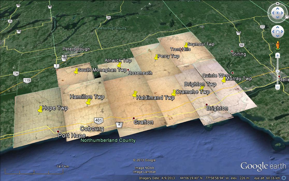
Screenshot from Google Earth showing the 1878 maps of the townships overlaid.
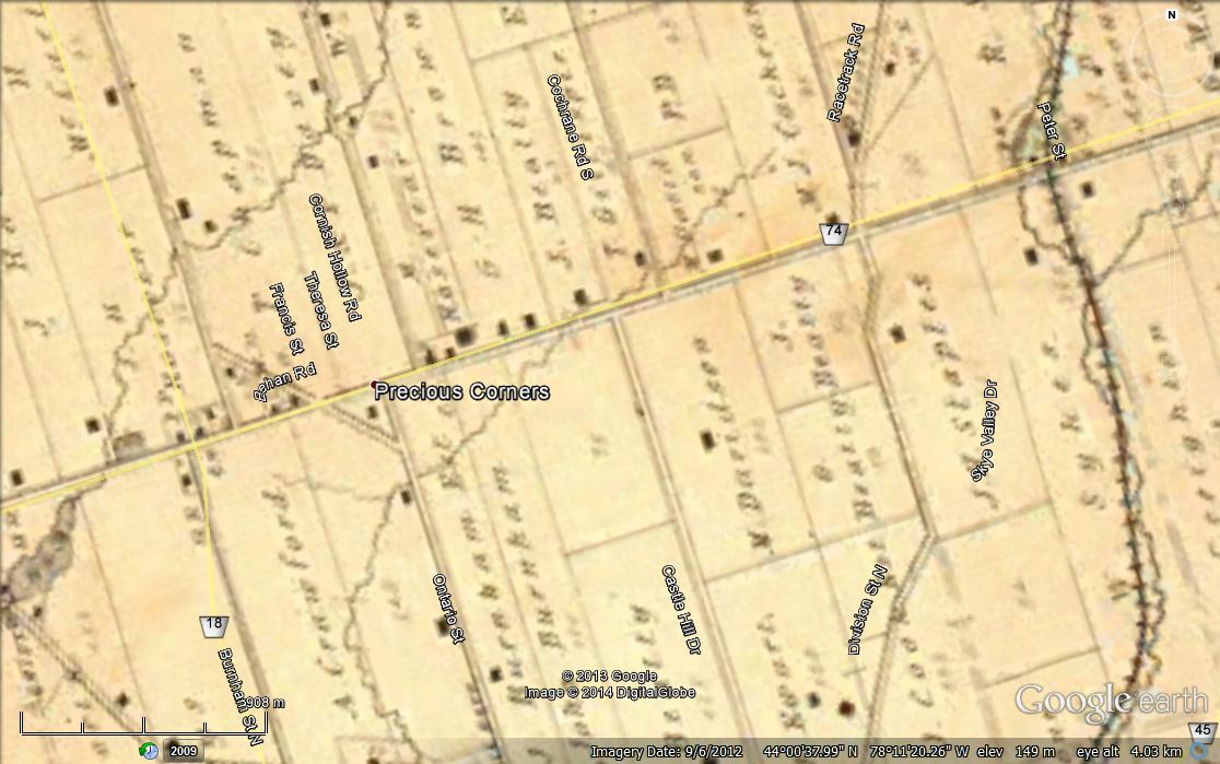
Google Earth zoomed into a township map, current roads and streets names and lines appearing as zoom increases. Current physical features are exposed by making the map overlay more transparent.
System Requirements
System Requirements
Download and install Google Earth for Desktop | Free for PC, Mac or Linux to a suitable computer, i.e., one with adequate drive space, RAM and graphics memory as summarised here. As Google Earth works with now-ancient Windows XP, the hardware requirements may not be very demanding but inadequacies will manifest as jerky and slow zooming and display. A good Internet connection is also needed because the image files total in the tens of megabytes, not to mention the data from the Google Earth database itself.
As of Feb 2014, the Google Earth Plugin for web browsers and Earth View in Google Maps do not seem capable of rendering this imagery correctly. The Google Earth for mobile apps renders the digital map imagery correctly but provides no control over them, i.e., turning off/on, varying transparency, etc.
Procedure
Procedure
Summary: download the KMZ file, open it with Google Earth, use its controls to select which maps to show, zoom, vary transparency, etc.
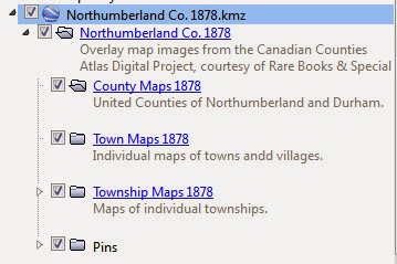
Download
A. Left-click or right-click and Save As on Northumberland Co. 1878.kmz.
OR
B. Click on the down arrow beside a KMZ file name at the bottom of this page.
(B) is recommended for use with browsers on mobile devices equipped with the Google Earth app to minimise memory consumption and to select what is displayed.

Opening view in Google Earth for Desktop in Windows 7. The sidebar can be toggled on/off and resized.
Open the KMZ file you just downloaded with Google Earth for Desktop.
Double-click on the KMZ file in your file browser or, from Google Earth, use the main menu File > Open to open its file browser to locate and open the file.
The initial view should be similar to the screenshot at the top of this procedure. Be sure to turn on the sidebar: main menu View > Sidebar so that you can see the heading Temporary Places and the sub-heading Northumberland Co. 1878 in the Places column

(this sidebar view is n/a in the Google Earth app for mobiles)
Click on the open arrows to expand the listing to show the sub-folders and contents. You can check or uncheck any boxes to control what is displayed in Google Earth.
(n/a for the mobile app)
There is no arrow beside the County Maps and the Town Maps because those folders were empty at the time of writing.
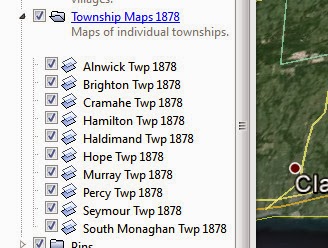
Here is the Places listing under the Township Maps sub-folder. The icon indicates that the item is an overlay. These are the 1878 map image files from the Canadian County Atlas Digital Project.
(n/a for the mobile app)
To vary the transparency of any overlay so that it is possible to see features below, select (highlight) the overlay item in the Places sidebar and Edit > Properties or right-click on it and select Properties from the pop-up menu. That should open a window similar to this one. Adjust the Transparency slider bar between Clear and Opaque.
(n/a for the mobile app)

For more on how to use Google Earth, please refer to its Help Resources and the Google Earth Community under its main menu Help.
We hope that you find 1878 Northumberland in Google Earth to be a useful complement to the Canadian County Atlas Digital Project. Your comments are welcome via Contact.
Accuracy & Resolution
Accuracy & Resolution
There is no perfect match between the images of the 1878 maps and Google earth despite sliding, stretching and squeezing them every which way - a "best fit" was sought for major roads and streets. Google Earth's own Roads graphics do not align exactly with the satellite imagery. We do not know what level of care was taken in drafting the original maps to scale, based on what quality of survey data. Some village maps are little better than sketches. Add distortions in printing, dimensional changes in the paper due to age, and scanning difficulties and some area of a map may align well but others are way off.
The image files themselves are reported to be 72dpi resolution on the Canadian County Atlas website and are just barely readable due to the low resolution and JPG compression. However, that keeps the file sizes moderate, important for reasonable response time over the internet and for rendering speed. Higher resolution 300 dpi TIF files may be ordered from the McGill Library for more detailed examination for a fee but high resolution images with watermarks can be examined freely online at Historic MapWorks.
Copyright & Credits
Copyright & Credits
Map images from The Canadian County Atlas Digital Project, courtesy of Rare Books & Special Collections, McGill University Library, and overlaid on Google Earth courtesy of Lakeshore Genealogical Society. Reuse in whole or in part is permitted provided this statement is included in all instances. The original source is Illustrated historical atlas of the counties of Northumberland and Durham, Ont. Toronto : H. Belden & Co., 1878; originals and reprints are accessible in many libraries and archives.
Page updated
Google Sites
Report abuse